X

CHCNAV
AlphaUni 20

Multi-platform Premium LiDAR

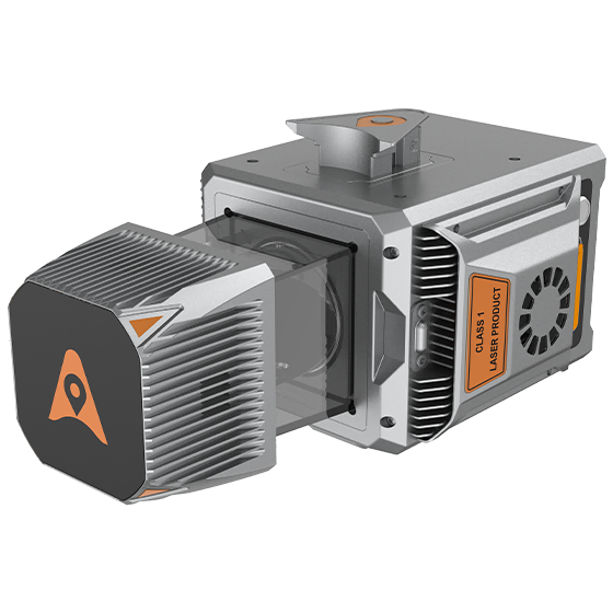
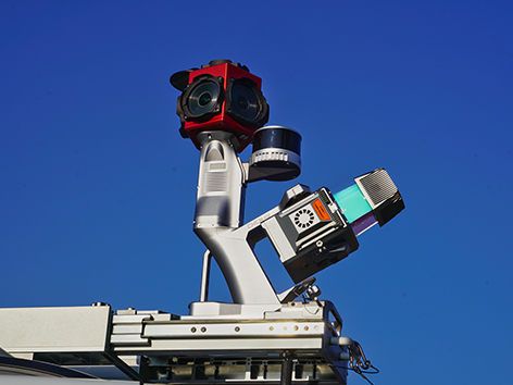
The AlphaUni 20 is a cost-effective, premium multi-platform mobile mapping system built on CHCNAV’s advanced LiDAR technology. Designed for accurate point cloud generation, it’s well suited to vehicle-based surveying tasks such as footpath assessment, highway maintenance and asset management.

For airborne applications, the AU20 boosts survey efficiency with strong vegetation penetration, long measurement range, and high levels of data accuracy and density—making it a reliable choice for a wide range of Australian surveying conditions.

Features

High Accuracy

Absolute accuracy of 2 to 5 cm, even in difficult site conditions.
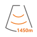
Long-range

Scan up to 1450 m with high point density.

Multi-Platform

Flexible integration with UAVs, vehicles, and backpacks.

Precision GNSS + IMU

High-precision navigation system for accurate data collection.

Benefits

Achieve outstanding accuracy with the AU20 advanced navigation algorithm and 5 mm repeated ranging accuracy. Ensure precise point cloud generation even in demanding environments.

Benefit from long-range capabilities up to 1450 meters and high-speed scanning at 2 million points per second. Cover large areas efficiently with high-density data collection.

Capture ground surfaces effectively with up to 16 target echoes. Generate accurate DEMs and DSMs even in densely vegetated areas, improving data quality in challenging environments.

Easily switch between crewed and unmanned aircraft, land vehicles, and backpack setups. Enjoy versatile applications from road surveys to airborne mapping, enhancing operational flexibility.

Operate in various field environments with the IP64-rated, lightweight (2.82 kg) AU20. Ensure reliable performance and easy integration with multiple platforms, from UAVs to vehicles.

Streamline your data acquisition with SmartGo software for real-time mission monitoring and CoPre software for intelligent point cloud processing. Achieve high-quality results with minimal effort.

Install the AU20 quickly with Alphaport's one-click connection. Minimize setup time and maximize productivity across various survey missions.

Industry Use Cases

Digital Twin Creation

Road Corridor Mapping

Railway Track Surveys

Mining Site Surveys

Product Specifications

Laser Scanner

  • Range : 1450 m
  • Scanning rate : 2.000.000 pulses/sec
  • Field of view : 360°
  • Returns : Up to 16

Sensors

  • Camera : Optional
  • Resolution : 45 MP
  • Focal length : 21 mm / 35 mm

Positioning

  • GNSS : Full GNSS
  • IMU : 600 Hz
  • Precision max. : < 5cmH / < 5cmV