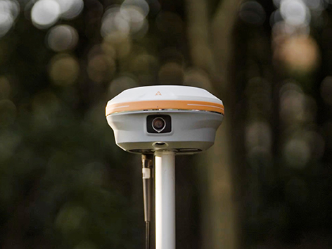
The i93 Visual IMU-RTK GNSS receiver combines advanced GNSS, IMU, and dual-camera video photogrammetry to deliver a streamlined and intuitive user experience. Its 3D visual stakeout and offset measurement features help improve efficiency on site, particularly across construction and civil projects.
Powered by CHCNAV’s iStar algorithm, it leverages multi-band GNSS channels and hybrid positioning to maintain reliable accuracy in challenging conditions—making it a versatile, all-round solution for a wide range of Australian surveying applications. BOOK A DEMO REQUEST A QUOTE
Features
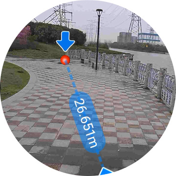
Visual Surveying
Dual cameras extract survey-grade 3D coordinates improving measurement efficiency.

Visual Stakeout
Guidance by a clear, eye-catching directional information.

3D Modeling
Dynamic panoramic video capture.
Auto-IMU Technology
200 Hz Auto-IMU for automatic pole tilt compensation.
Benefits
Industry Use Cases

Topographic Survey

Boundary Survey

As-built Survey

3D Modelling
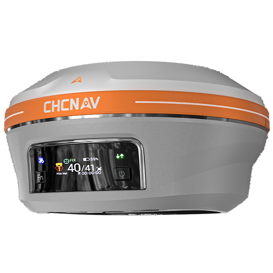
Product Specifications
Positioning
- GNSS : Full GNSS
- IMU : 200 Hz
- Precision max. : 0.8cmH / 1.5cmV
Physical
- Weight : 1.15 kg
- Dimensions : 152 x 81 mm
- Battery life : Up to 34 hours RTK rover
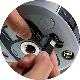
Connectivity
- Wireless : Bluetooth, Wi-Fi
- Cellular : 4G LTE
- Modem : 410 - 470 MHz, Rx/Tx
Sensors
- Camera: Dual
