X

CHCNAV X500

This is a line of text as an overview to what this product is. A brief description if you will.

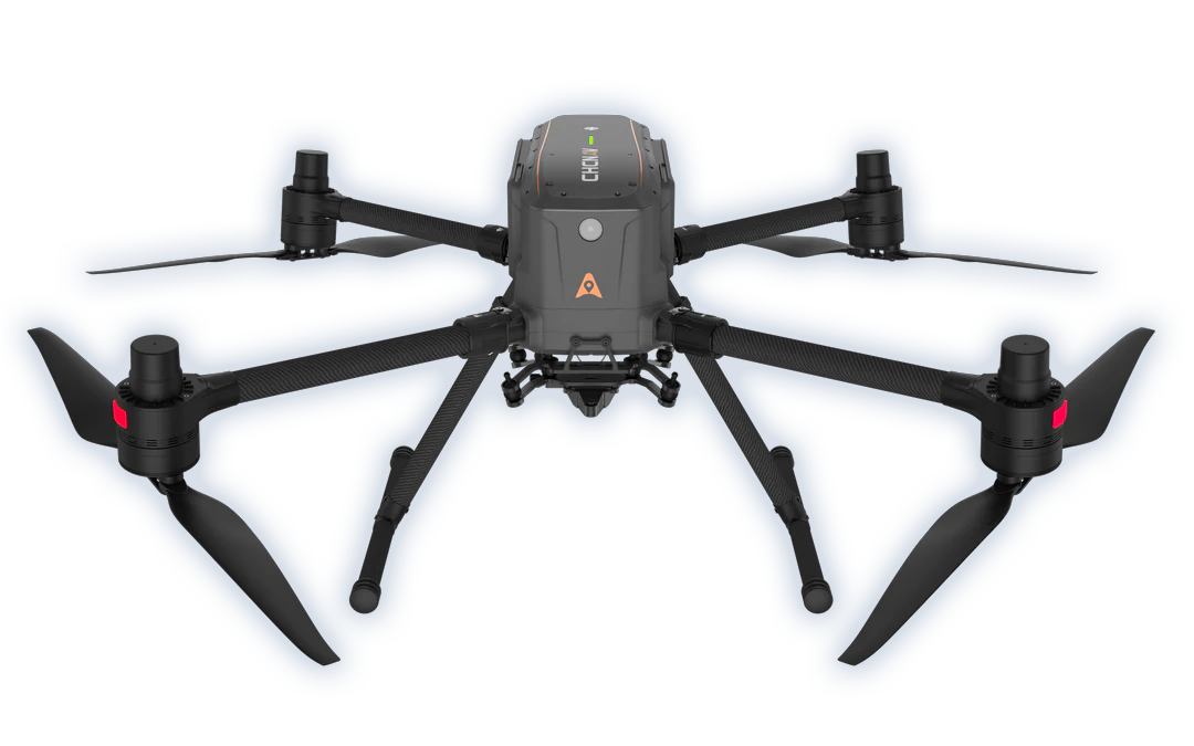
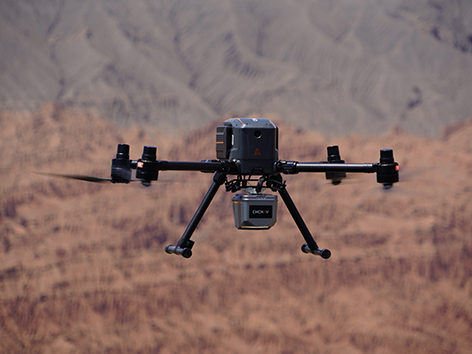
The CHCNAV X500 rotor UAV is a professional-grade drone built for serious payload capacity and long flight times. Featuring advanced flight controls and high-precision positioning, it offers excellent manoeuvrability, stability, and overall performance in the air. With built-in visual SLAM and obstacle detection radar, it enables smart, safe operation even in complex environments.

Compatible with CHCNAV sensors as well as a wide range of third-party payloads, the X500 is well suited to Australian applications including surveying, urban monitoring, emergency response, disaster recovery, and infrastructure inspections.

Features

Reliable
Design

Adjusts altitude to avoid crashes. Landing even if a propeller malfunctions.

Hot-Swap Batteries

Seamless takeoffs and continuous power for multiple flights.

Intelligent Battery Station

Functions as a power bank for greater efficiency in the field.

Lightweight and Portable

Single-person operation and easy transport.

Benefits

The X500 supports a 5 kg payload capacity and offers a flight endurance of 58 minutes, or up to 50 minutes when equipped with the CHCNAV AA10 LiDAR. Its IP55 rating and 12 m/s wind resistance enable reliable performance in challenging environments.

The X500 features robust redundancy with dual GNSS, triple IMU backups, dual-redundant flight control, and safe return strategies. Its millimeter-wave radar ensures precise obstacle detection and avoidance, including trees, buildings, and towers. The V-SLAM visual positioning system enables landings on moving vehicles and vessels.

Paired with the BS10 charging station, which holds up to six batteries, it allows fast charging from 20% to 90% in just 40 minutes ensuring uninterrupted operation throughout

The X500 supports up to 3 concurrent payloads and is compatible with CHCNAV LiDARs and cameras. Its open SDK interface facilitates integration with third-party devices, enabling customization for specific mission requirements. Built on the universal Mavlink protocol, it ensures adaptability to multiple applications.flow.

The X500 uses CHCNAV’s video transmission system with a range of up to 20 km. Advanced algorithms optimize HD video transmission by minimizing latency and enhancing reliability. Its 1080p HD FPV feed and 10.1" large-screen remote control provide intuitive operating experience.

CHCNAV SmartGo ground control software supports diverse flight path options, including rectangular, strip, polygonal, and facade routes. It provides real-time updates on the drone's status, heading, and surrounding obstacles, ensuring enhanced safety for beyond-visual-line-of-sight (BVLOS) operations.

Industry Use Cases

Geospatial
Surveying

Urban
Surveillance

Emergency
Scouting

Disaster
Relief

Product Specifications

Imaging

  • Resolution : 45 MP
  • Focal length : 35 mm
  • Camera lenses : 1
  • Capture interval : 1 s minimum

System

  • Weight : 290 g
  • Dimensions : 5 x 63.5 x 102.5 mm